
The Grand Canyon, Zion, and Bryce Canyon lie within 500km of each other, connected by straightforward highways and a landscape that shifts dramatically every 100km. Most people who drive to one end up visiting all three—the Southwest road trip is the most logistically coherent multi-park loop in America because the roads are simple, the signposting clear, and the scenery between parks is genuinely exceptional, not filler. This loop covers 1,000–1,200km of total driving depending on your start point. The distances are real, but they move at 100–110 km/h on empty highways, and you'll spend more time on trails than in the car.
Does the America the Beautiful Annual Pass make sense for this trip?
Yes. The pass costs $80 per vehicle and covers all US National Parks and federal recreation areas for twelve months. On this loop, you'll pay $35 per vehicle at Grand Canyon, $35 at Zion, and $35 at Bryce Canyon—that's $105 before you consider Glen Canyon National Recreation Area (Lake Powell area) or Antelope Canyon access. The pass breaks even at three parks and saves money thereafter. Buy it at the first park entrance or online before you leave. Monument Valley Tribal Park has a separate $20 vehicle fee that the America the Beautiful pass does not cover.
Las Vegas to Grand Canyon: routes and timing
Four hours and 450km separate Harry Reid International Airport (LAS) and Grand Canyon South Rim via Interstate 40 east to Williams, Arizona, then Arizona Route 64 north. This is the only direct route; it's unscenic for the first two hours, then improves. Alternatively, drive north via the Valley of Fire State Park (45 minutes out of Las Vegas, striking red sandstone formations, adds 30km to the journey but worth it on the return). There is no fuel between Flagstaff and Cameron on Route 64, so fill up in Williams.
The North Rim (open mid-May through mid-October) sits 450km from Las Vegas via a different approach—north through Utah's Marble Canyon via Route 89A. It's more isolated, has fewer services, and offers a different perspective on the canyon itself, but most first-time visitors use the South Rim for its year-round access and established infrastructure.
Grand Canyon South Rim: what to expect and what kills people

The South Rim is open year-round and maintains the widest range of services—lodging, restaurants, a visitor centre, and a medical clinic. The rim itself sits at 2,100m elevation; the canyon bottom is another 1,500m below. Sunrise from Mather Point (east of the visitor centre) reveals the full width and depth; midday light flattens the canyon and washes out the colour. Morning is non-negotiable if you want photographs.
The Rim Trail runs 21km along the canyon edge, mostly flat and paved in sections. Mather Point and Hopi Point are the main viewpoints; you can walk between them in 3–4 hours at a slow pace. This is the hike most people do, and it is entirely sufficient for understanding the scale of the place.
Hiking into the canyon is where people fail to estimate the difficulty. The Bright Angel Trail descends 7km to Indian Garden or Havasupai Gardens (2,200m elevation loss) in 3–4 hours downhill. The return climb in summer heat—where temperatures at the river reach 38°C—kills multiple people every year. The NPS is not exaggerating: heat exhaustion and rescue operations occur weekly in June through August. If you hike into the canyon, start before 7 a.m., turn back by noon, and carry 3–4 litres of water minimum. A single night at Phantom Ranch at the canyon bottom (the only overnight option in the canyon itself) requires a lottery permit and months of advance booking. Most visitors skip this.
Where to stay: Bright Angel Lodge sits on the rim ($160–280/night for basic rooms, advance booking essential in peak season), or drive to the town of Tusayan 10km south for cheaper motel rates. Mather Campground ($18–36/night, book via recreation.gov) fills months ahead in summer.
Grand Canyon's weather by month: when to go
| Month | Conditions | Crowds | Verdict |
|---|---|---|---|
| January | 2–10°C, clear skies | Low | Good |
| February | 3–11°C, few clouds | Low | Good |
| March | 7–16°C, increasing haze | Low-Moderate | Good |
| April | 12–22°C, excellent | Moderate | Best |
| May | 17–28°C, rare storms | Moderate-High | Best |
| June | 23–34°C, afternoon thunderstorms | High | Avoid |
| July | 25–36°C, frequent storms | High | Avoid |
| August | 24–34°C, daily storms | High | Avoid |
| September | 21–31°C, clearing | High-Moderate | Best |
| October | 15–26°C, stable | Moderate | Best |
| November | 9–18°C, increasing clouds | Low-Moderate | Good |
| December | 3–10°C, occasional snow | Low | Good |
April–May and September–October are genuinely the best months—stable weather, manageable crowds, and temperatures that allow hiking in daylight hours without heat risk. June–August brings peak crowds, afternoon thunderstorms, and canyon-bottom temperatures that exceed 37°C; hiking is possible only at dawn. Winter is quiet and clear but cold; bring layers.
Grand Canyon to Zion: the Vermillion Cliffs drive
The 250km drive from Grand Canyon South Rim to Zion via Highway 89A and 89 through the Vermillion Cliffs is one of the great scenic drives in the United States. It is not a diversion—it is the experience itself. The road descends from the Grand Canyon plateau into the marble canyon, passes the Navajo Bridge, and ascends into Utah's slickrock country. Allow 2.5 hours and plan to stop at Vermillion Cliffs Scenic Overlook (30km north of the rim).
Critical detail: this section has zero services for 100km between Jacob Lake and Marble Canyon. Fill the fuel tank before leaving the Grand Canyon South Rim or in Jacob Lake (a small community with one motel, a trading post, and a fuel pump). If you arrive at Zion after dark, you'll have missed the drive—reschedule if possible.
Zion National Park: the shuttle, Angels Landing, the Narrows
Zion's canyon road is closed to private vehicles April through October. A free shuttle bus runs continuously from Springdale (the gateway town) to The Court of the Patriarchs, Angels Landing trailhead, and the Temple of Sinawava at river's edge. The shuttle is mandatory during this period. Arrival before 8 a.m. or after 3 p.m. reduces wait times; mid-morning queues can exceed 45 minutes during peak season (June–July).
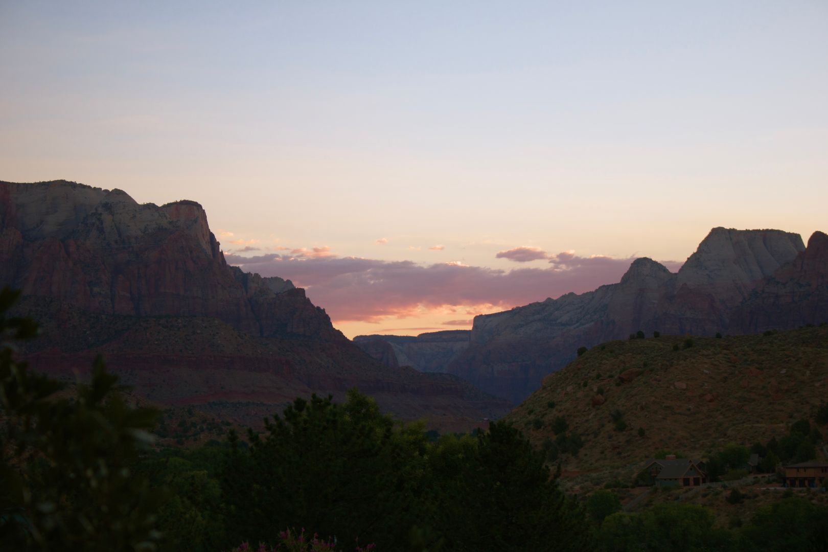
Angels Landing is the apex hike—8km round trip from the shuttle stop, 487m elevation gain, and a chain-assisted scramble along a narrow ridge with 400m exposure on both sides. Permits are now required year-round ($6 per person via recreation.gov). The permit system is a lottery; apply 4–6 weeks in advance. Sunset light on the Watchman (the landmark rock formation) is the photograph everyone wants, but weather and cloud cover vary dramatically.
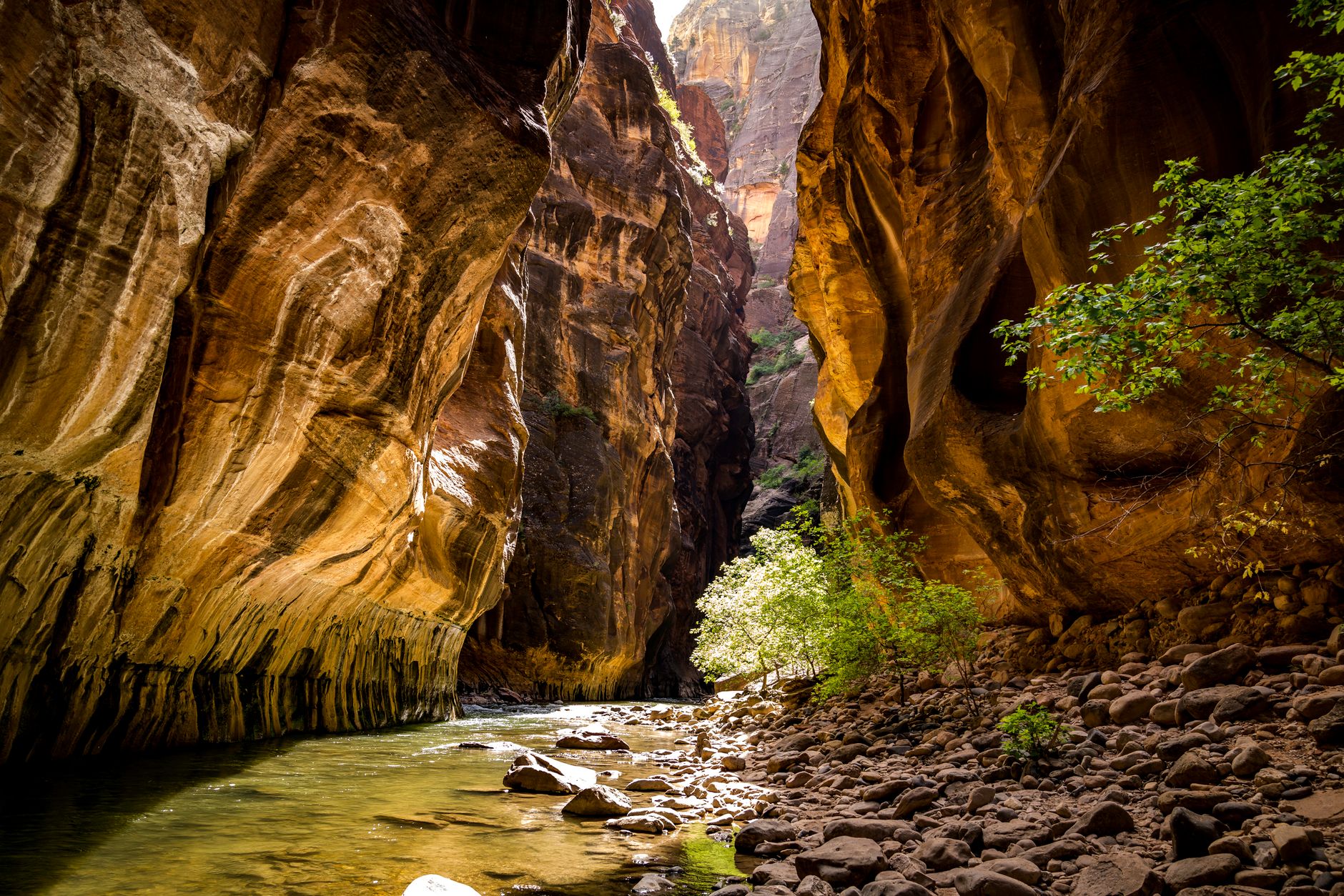
The Narrows—hiking up the Virgin River through a slot canyon with walls climbing 600m on each side—is the other signature experience. The river is 0.3–1.2m deep depending on recent rainfall. Water shoes or waterproof boots are non-negotiable; rental shops in Springdale charge $15–20 per pair. There is no permit required for the bottom-up approach. The hike is achievable in 2–4 hours for a partial ascent (3km up, return the same way) or 6–8 hours for full hikers who reach the exit at Left Fork. This hike is busier than Angels Landing but feels more intimate due to the canyon width.
Where to stay: Springdale (the gateway town, 5km from park entrance, $150–280/night for decent motels) or campgrounds. Zion Canyon Campground in Springdale ($50–60/night) has hookups. South Campground and Watchman Campground inside the park ($32–50/night) book out 6 months ahead via recreation.gov.
A first-time visitor underestimates the red heat reflected off canyon walls at midday. The stone radiates, and you feel it underfoot and around you. Hike early, rest during midday, resume in late afternoon.
Zion to Bryce Canyon: a 90-minute transition
Ninety kilometres and 1.5 hours separate Zion and Bryce Canyon via US Route 9 east and US Route 89 south. The landscape shifts from red slot canyons to high desert plateau. Bryce Canyon sits at 2,400m elevation (500m higher than Zion rim), so temperatures drop noticeably even in summer.
Bryce Canyon: hoodoos, sunrise, and what it actually is
Bryce Canyon is not a canyon in the geological sense—it's a series of natural amphitheatres eroded into a limestone plateau, filled with hoodoos (tall, thin spires of coloured rock). The rock is softer than Grand Canyon sandstone, and erosion works faster, creating the distinctive forest-like density. Sunrise turns the hoodoos a deep orange-red; midday washes them out.
Sunrise Point and Sunset Point sit 5 minutes' walk from the visitor centre. Most people stop here, take photographs, and move on. The Rim Trail connects the main viewpoints (8km, mostly flat, achievable in 2–3 hours at a slow pace). Navajo Loop and Queen's Garden Trail descend 166m into the amphitheatre via switchbacks (5km loop, 1.5–2 hours) and get you among the hoodoos themselves—this is the essential experience.
Best months: May through October. Bryce at 2,400m is cold at night even in summer—temperatures drop to 2–5°C in June. Bring a fleece. Snow falls October through April and transforms the hoodoos into something otherworldly; winter visitation is quiet but rewarding if you can tolerate cold mornings.
Where to stay: Bryce Canyon City (immediately outside the park boundary, $130–200/night for basic motels) or Bryce Canyon Lodge inside the park (historic building, book 6+ months ahead, $200–300/night). Bryce Canyon Campground inside the park ($30–40/night) books 5 months in advance via recreation.gov.
Bryce Canyon vs. Grand Canyon: the critical difference first-timers miss
This is where the article diverges from typical travel writing. Most people assume Bryce Canyon is a smaller or less impressive version of the Grand Canyon. This is wrong and leads to disappointment.
The Grand Canyon is defined by depth—you stare down 1,500m into an abyss. It is about scale and vastness. Bryce Canyon is defined by texture and geology. You are among the features, not looking down at them from a distance. The hoodoos have distinct shapes; you notice individual formations. Bryce's best views are at sunrise and sunset when the light is raking and colour-saturated. The Grand Canyon's best views are at dawn when the light reveals the layers and the scale.
If you have limited time, choose based on what you want: Grand Canyon for the emotional impact of vastness, Bryce for the visual spectacle of rock colour and form. But most first-time visitors should do both—the drive between them is short, and the experiences do not overlap.
Optional addition: Monument Valley and Antelope Canyon
Monument Valley Tribal Park (the tall red mesas straddling the Arizona-Utah border) lies 300km southeast of Bryce Canyon (3 hours' drive) and adds a full day to the itinerary. It is a Navajo Nation park, not a US National Park, so the America the Beautiful pass does not apply; entry is $20 per vehicle. The landscape is dramatic—isolated red buttes rising from a flat desert floor—but it is visible entirely from a 17km loop drive (no hiking required, though hiking into the valley is possible with a Navajo guide, $40–80 per person). Many people find it the visual climax of the trip; others see it as a side attraction.
Antelope Canyon (near Page, Arizona, 60km north of Monument Valley) is a slot canyon famous for light beams filtering through the upper narrows. Access is by guided tour only ($60–80 per person, 1.5–2 hours, book ahead via GetYourGuide or the tour operators on-site). It is genuinely stunning if you tolerate guided-tour crowds and timing; the light beams appear mid-morning and are heavily photographed.
If you add Monument Valley, the route becomes: Las Vegas → Grand Canyon → Zion → Bryce Canyon → Monument Valley → return to Las Vegas (adding one day and 300km to your driving). If you skip it, Bryce Canyon → Las Vegas is a straightforward 400km, 4-hour drive back west.
Crowding and booking strategy by season
April–May: shoulder season. Weather is stable, temperatures are mild, and crowds are moderate but rising. Book lodging 2–3 months ahead. Expect shuttle queues at Zion but not hour-long waits.
June–August: peak season. 38°C temperatures in canyon bottoms, afternoon thunderstorms, and maximum crowds. Zion shuttle waits exceed 45 minutes mid-morning. Hotels in Springdale and Bryce Canyon City are booked 6+ months in advance; last-minute options are scarce. If you travel during these months, arrive at parks before 8 a.m. and plan to hike only at dawn.
September–October: the best window. Crowds drop sharply after Labor Day. Temperatures moderate to 22–27°C. Lodging is easier to book 6–8 weeks ahead, and the shuttle waits drop to 10–15 minutes. Services (restaurants, visitor centres, ranger programmes) are fully operational. This is peak season for experienced travellers.
November–March: quiet but compromised. Grand Canyon South Rim is open. Zion and Bryce are open but with reduced services (some restaurants and facilities close). Snow is frequent at Bryce (adding visual drama) and rare at Zion or Grand Canyon South Rim. Cold nights make camping uncomfortable without proper gear. Winter is for travellers who enjoy solitude and don't mind freezing mornings.
Practical logistics: car rental, fuel, maps, water
Rent a car at Harry Reid International Airport (Las Vegas). Major operators (Hertz, Avis, Budget, Enterprise) all operate from terminal 1. Book the rental 4–6 weeks ahead; peak-season rates spike (automatic transmission mid-size sedan: $40–60 per day in April–May, $70–90 in June–August, $35–50 in September–October). All-wheel drive is not necessary; a standard sedan handles every road on this itinerary.
Fuel is the second-largest variable cost. Expect 900–1,100km of driving depending on your Monument Valley addition. Fill up at predictable points: Las Vegas (start), Williams, Arizona (before Grand Canyon), Marble Canyon or Fredonia, Arizona (before heading north to Zion), and Springdale or Hurricane, Utah (before Zion). The stretch between Page, Arizona, and Bryce Canyon is 160km with one fuel stop; do not arrive on fumes.
Cell service: expect spotty coverage in the parks themselves. Download offline Google Maps for the entire region before you leave Las Vegas (the offline map takes 500MB). Mark fuel stops and lodging locations on your offline map.
Water: carry a minimum 2 litres per person for any hike longer than 2 hours. For Grand Canyon hikes, 3–4 litres is mandatory. Refill at visitor centres and lodges. Tap water is potable everywhere.
Recommended itinerary and final verdict
The ideal trip is seven days minimum: one night before driving (Las Vegas), one full day at Grand Canyon South Rim (sunrise walk, rim trails, early departure), 2–2.5 days in Zion (one major hike like Angels Landing or the Narrows, one day for acclimatization and minor trails), one full day at Bryce Canyon (sunrise, Rim Trail and/or Navajo Loop, return), and one night in Springdale or Bryce Canyon City on the return to break the drive. A ten-day trip adds Monument Valley and Antelope Canyon, which is worth it if you can manage the extra time.
Go in September through October if you can control your dates. Spring (April–May) is the second choice. Avoid June through August unless you have no alternative—the heat at Grand Canyon and Zion bottoms reaches dangerous levels, and crowds eliminate solitude. The drive from Las Vegas to Grand Canyon South Rim to Zion to Bryce Canyon and back totals roughly 1,000km and is logistically straightforward. The one variable first-timers consistently underestimate is the elevation change: you'll move between 350m (Las Vegas) and 2,400m (Bryce Canyon) multiple times, and the cold nights at Bryce in May and September surprise people who packed only for heat. Bring layers.
Frequently Asked Questions
How many days do I need for the Grand Canyon, Zion, and Bryce Canyon?
Seven days minimum for the core loop (one night each at or near the three parks, plus a night in Las Vegas or Springdale). This allows one full day per park for the main trails. Ten days is optimal—it adds Monument Valley, gives you two days per park, and breaks the driving into manageable chunks. Five days is insufficient; you'll spend more time in the car than on trails.
What's the best time to visit Grand Canyon?
April through May and September through October are best. Temperatures range 15–26°C, crowds are moderate, and weather is stable. June through August brings heat exceeding 37°C in the canyon bottom, afternoon thunderstorms, and peak crowds with shuttle queues exceeding 45 minutes. Winter (November–March) is quiet and clear but cold; the South Rim stays open, but services are reduced.
Is the Zion shuttle mandatory?
Yes, April through October. Private vehicles cannot access the canyon scenic road during these months. The shuttle is free and runs continuously, but waits can exceed 45 minutes mid-morning in June and July. Arrive before 8 a.m. or after 3 p.m. to minimize delays.
Do I need permits for hiking at Zion?
Angels Landing requires a permit ($6 per person) and is allocated via lottery through recreation.gov. Apply 4–6 weeks in advance. The Narrows (bottom-up route) does not require a permit. Most other popular hikes do not require permits, but check the park's website for current requirements.
Is Monument Valley worth the detour?
Monument Valley adds a full day and 300km to your loop, but the iconic red mesa formations are distinctive and worth seeing if you have the time. If you're constrained to seven days, skip it and spend extra time at Bryce Canyon or Zion. If you have ten days, add it on the return route via Page and Antelope Canyon.
Can I drive the loop in reverse (Las Vegas → Bryce → Zion → Grand Canyon → Las Vegas)?
Yes, logistically it works identically. However, you'll approach the Grand Canyon from the south (less scenic drive) and end your trip facing the return to Las Vegas rather than building toward it. The conventional west-to-east order (Las Vegas → Grand Canyon → Zion → Bryce) follows the natural landscape gradient and ends with the highest elevation, so you're driving downhill on the return. Either works, but the conventional order has a minor advantage.